Schedule of Arrivals

Wednesday, October 29, 2008

Shore Acres State Park Oregon

Journey to a Land of Water Wind and Fire

Part B: The Oregon Coast III f

A Trip Highlight

The thing that really impressed me then, and impresses me still, about the Simpson Beach area of Shore Acres State Park, however, was/is not the surf. Rather, the thing that impressed me the most was the rocks that I saw there. Now, again, remember, I am no Geologist, and have never even had a course in the subject. I know you have sedementary rocks and igneous rocks, one formed by sea sediment, and one formed as a result of volcanic action, but beyond that, I am just a mere tourist(Yes, I know there are more kinds, but I have to go look that up). That said, I was impressed with what I saw. And more importantly, I was impressed with how the rocks I saw left tantalizing suggestions about how things were millions of years ago when the hot lava from the Cascade Volcanoes came down and met the sea, and all the heating cooling and upheaval that occured as a result of this action. And as I walked among the rocks, in most places dwarfed by their size, I simply observed and marveled. No I don't know exactly what happened back then, but whatever it was, it was surely literally "earth-shattering."


There were a few "rocks" that were all scarred, scraped and coated with pocks. These were interesting, but not a new phenomena for me. I had seen similar rocks both at Tobermory ON, and Kelly Island Ohio. So, based upon the presence of these, while I would have liked Simpson Beach, I would not have been as over-awed with it as I became.


No, it was the combination of the sandstone with lava interspersed that put me" over the top." The sandstone was not the substantial kind such as I see on our place in Greenbrier County WV a lot of the time. Simpson Beach Sandstone was a more fragile sandstone. At one point when I rubbed two of the rocks together very gently, they still crumbled away. Further, they had swirls and strands of color in them that reminded me of a grey-like marble cake. And then into the midst of this marble cake dough-like rock, there was a hard chunk of lava suspended.


As noted in my last blog, there was a cave at the beach as well. It was a good sized one, as the picture shows. I went over to the entrance, but did not go in. J. far more adventurous than me, did go in. He said the walls of it looked much like the cliffs there at the beach. So how and why did it form? Sure it was from water erosion, I said the sandstone was very crumbly. But why just this cave? Why hadn't the water washed away the rest of the cliffside?


Oh yes, one final piece to make this stop on of the highlights of our trip for me. I found among these amazing rocks Tide Pools. I had mentioned earlier when I was blogging about Cape Perpetua, that I had hoped to see the Tide Pools there, and was disappointed I had arrived at the wrong time in terms of the tides. Well here, I was able to see a few of them.


In short, this was one amazing place. It was amazing in what it was, and in what it suggested it once had been. Would I return here again if I had the chance? You bet I would!

Tuesday, October 28, 2008

Shore Acres State Park Oregon

Journey to a Land of Water Wind and Fire


Part B: The Oregon Coast III e

On the Beach (Yet again)


Enough of worms and weather forecasting, it is already snowing outside for crying out loud! Back to Oregon and Shore Acres park.


When I last was posting about this spot, we were just leaving the Formal Gardens and headed for Simpson Beach. J. had talked about Simpson Beach in terms of "You really need to go. . ." and "You'll really like it . . ." and my experience with him has been that when he says that, listen. Still, as I caught my first glance on the trail down, I was not too impressed. It's a beach, yes, and it has rocks, yes. But to earn all this amount of concerted devotion that J. seemed to have for it?


And as I rounded the bend and got my first good look, I still wasn't sure that it was all that special. And then I took a second look and began to notice, well, . . . things are a little different here. The tear-drop shape of it, for one thing gave me a slight tip off. And over on the left side I noticed . . . a cave in the cliff. And then, . . . those rocks on the right. Well, . . . maybe there is something to this.


Upon arriving at the beach I walked over towards the right and spied these upthrusting bits of what appeared to be sedementary sandstone, with more evidence of volcanic activity in them. But it wasn't just the rocks, it was the whole scene that sparked my curiosity. And then I realized I had seen this scene several times before in promotional literature for the Oregon Coast. That was when I realized that apparently this is a favorite spot for people to come to watch the storms break onto shore. (It makes no sense to me that people would actually travel many miles just to watch a weather front come on shore, but people do. Then again, people Bungee Jump off the New River Gorge Bridge in WV on Bridge Day each October.)


Next, I walked over towards the left in order to get a better view of the rugged rocks.


Now this was mid-August and the storms were not coming in. However, the tide was, and so that meant that there was some wave action to be seen. Not as much as in the winter months, that is for sure. But still there was some wave action.


And then, I began to realize that the rocks were a lot bigger than I first had thought. "How big?" you may ask. Well to answer that I saw some boys standing along the cliff out aways from where I was. So I took a shot of them in order to provide some perspective.


Finally, I pulled back from my spot upon the ledge and just watched the waves roll in over the rocks. And I wondered: "What would it be like to be here when a storm came in? How big do those waves really break?"


And: "How far do they come rolling in on the beach? . . . And what damage do they do? What would it be like to be here and watch that ? . . ."


Oh my, what next, Bungee Jumping? (Note Bridge Day for this year is past and no way would you ever find me there. Which is to say, the spell broke.)

Sunday, October 26, 2008

Winter Forecast

The Woolly Worm Forecast


We interrupt the Journey to a Land of Water, Wind, and Fire, to bring you this late breaking news. No, nothing to do with the election, it's pretty much a non-event in West Virginia. No, this is far more important.

It's Woolly Worm Time in West Virginia. And as we all know that means our Winter Weather Forecast has arrived. Yes, Punxsutawney PA may have its ground-hog, but West Virginia, and many other states, such as North Carolina have their woolly worm.

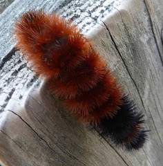
And this forecast of mine has been "cross-checked." That's right, talking with one of the guys at church this morning, I found that he had seen a woolly worm similar to the one pictured above (found on our farm in Greenbrier County) while playing golf at the Stonewall Jackson Resort in Central West Virginia. To date, I have seen no others, so I can, with confidence, go with these two sightings and not bother myself with any future pesky sightings. (I'll just call any future sightings contrary to my predominate two: "Indeterminate Outlying Data.")

Now that we have our data, here we go with the "Fearless Forecast" based on what I was taught by the good folks of Greenbrier County many years ago, and officially proclaimed to a waiting world by the the late Charles Von Canon. He explained to a small crowd that huddled together in the sub-freezing temperatures at the first Woolly Worm Festival in the middle of October 1978, in Avery North Carolina: "The Wooly Bear caterpillar has 13 brown and black segments, which correspond to the 13 weeks of winter. The lighter brown a segment is, the milder that week of winter will be. The darker black a segment is, the colder and snowier the corresponding week will be."

As you can see, there is a prominent dark brown, verily black, band at the head of the woolly worm (it is headed down the Gatepost). This dark brown is followed by a long, light brown coat, with just a touch of dark "wool" at the rear. This means that winter will start off cold and snowy, then it will settle down and be a mild winter for the rest of the time, with the exception of one very brief bad spell sometime in mid to late March.

So, now you know: that's what our winter will be like.

Of course, this is a West Virginia Forecast only. To be truly accurate, you will need to read the woolly worms in your particular locale. And remember, if you see more than one and come up with different forecasts, you're on your own as to how to determine which one is right (or you can proclaim all of them are correct and wait for Spring to proclaim that winter was just as you and the woolly worm predicted it would be).

Let me know what your woolly worms say.

And keep track of your winter weather and let me know how accurate the woolly worm (mine or yours) is for your location. Who knows, we might turn this into a "true" blog dedicated to scientific research instead of one dedicated to the ramblings of an old man!

Saturday, October 25, 2008

Shore Acres State Park Oregon

Journey to a Land of Water Wind and Fire

Part B: The Oregon Coast III d

A Bit of Formality Amid All the Wildness

Given the rock formations in the last posting, and in the next 2 postings to come, this little of bit of a Formal Garden in Shore Acres State Park comes as a pleasant break. Perhaps that was what the 2nd Mrs. Simpson intended when she first developed these Gardens.


Now, as gardens go, even formal ones, I have seen larger, more extensive and yes, prettier ones. For example, this garden is nothing like Butchart Gardens on the island of Vancouver in British Columbia. But then, they do not have all the rocks and other wild things, such as the ocean, surrounding them.


Thus, you have this formal, almost oasis, to retreat to when the wierdness of the area starts to get to you. Yes, I think I see why Mrs. Simpson started these gardens, she knew that people coming to visit would need this bit of formalized beauty to help them cope with all the other things they saw.

Friday, October 24, 2008

Shore Acres State Park Oregon

Journey to a Land of Water Wind and Fire

Part B: The Oregon Coast III c

Entering Another World


Sitting back in good old WV reading the guidebooks, I had debated about visiting the South Slough National Estuarine Research Reserve to look for wildlife, particularly birds. The Preserve is located just to the south and west of Coos Bay Oregon. But our local "expert" J. said, "I really think you folks would like Shore Acres State Park, it has lots of neat surf and rocks and gardens and things." I must admit J. has a track record with me, when we visited Mt. St. Helen's a few years ago, he insisted we not "waste time" at the State Information Center, but go on up to the Johnson Ridge Observatory. My sister (his mother) and I finally listened and went on up. We were glad we did. So this time, when he suggested Shore Acres State Park, without a moment's hesitation I said: "Let's go with what the locals say!" And we were off.


This park has an interesting history. It started out as a turn of the century (the last century, not this one), oceanside home/getaway for a local lumber barron named Louis J. Simpson. The poor guy seemed to have a bit of bad luck and after building his "dream house" and living in it for a few years, his first wife died. Then his house burned down, and in the ensuing struggle he rebuilt a house using scrap lumber. His 2nd wife liked to garden and so she started a "formal" garden behind the house. But as time, and the Depression, marched on, his position became untenable. During WW II the Army closed the road to his mansion, and he turned the whole thing over to them. They cared for it about as well as soldiers care for anything that is given to them. Thus, the place was a shambles after the war. By then, Simpson had sold the whole thing to the State. Because the 2nd mansion was such a wreck after the Army got through with it, the state razed it. Finally, about 1974 the state began to take an interest in re-developing the place as a State Park. Their first project was to rehabilitate the "formal" gardens. And so, it has been re-habilitated gradually through the years.


Our first stop was at the site of the 2 mansions. As I said, there is no more Mansion, they are both gone. Instead there is a shelter overlooking the ocean. There is also a walkway out to the overlook, and so, that was where we went first. And we looked north:


And the view was interesting. A bit like Cape Perpetua, but not as high. Then we looked south:


And things began to look a bit different. For one thing, I noticed the very definite "Uplift" in the rocks. Some mighty force has been at work here. And then I noticed that the rocks were, themselves largely sedementary rocks, not caused by volcanic action. And yet, I knew that the residue from the various Cascade eruptions had made it to the sea here, at least according to the guidebooks I had read.


And then I looked right below where we were:


And what I saw astounded me. At first I thought those things on the rocks were large barnacles. And then I thought they might be algae, or some kind of mushroom. But then I realized, no, that is rock, a different kind of rock, lying on top of a huge sandstone rock.


I asked A. with her new 10x zoom camera to get a close-up of those formations. The results were even more telling. Then she went in close-up on another rock, and something else showed up. Here was a rock, coated with another substance that had been all bubbly at first, but now had hardened. The resultant formation was stunning to say the least, at least as far as I was concerned.


And then I looked north again at the rocks and the swirling surf, and I saw more evidence of this kind of rock overlayer on top of another different rock. Further, this second overlay coating of rocks had at one time been a light and airy liquid material that almost froze its bubbles in place as it cooled.


It was obvious to me why Simpson had chosen this spot for his house. It definitely had one of the most astounding views I had ever seen.

Now if this were a geology site, I expect at this point in this posting you would be given a long explanation about how all this came to be. But since I am no geologist (I took "Bonehead Physics" in College and was thankful to walk away with a "C") but only a traveler, I will simply leave you with the view and the comment that as wild as these pictures may appear to you, they are a pale second to seeing this site in person! Explanations or not! So if you ever come this way, you definitely must visit! Watch for more in my couple of postings and you will be given more information to back up why I say this.

Thursday, October 23, 2008

Oregon Dunes National Recreation Area

Journey to a Land of Water Wind and Fire

Part B: The Oregon Coast III b

Into the Woods

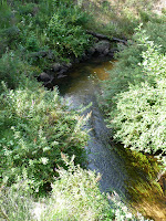
The John Dellenback Trail was not all large sand dunes. It was also a trail through an area with a diverse population of Flora. It was a trail that took us past a stream flowing freely.


And it was a trail where the woods were definitely larger than the ones we had seen the day before at the Day Use Area.


Not only were the trees larger, some of them were entirely new species for us (but not for J. who quickly told us the name of each species we saw), such as this truly beautiful Pacific Madrone tree.


But ultimately, the John Dellenback trail led us through the Dunes past many vast patches of sand covered with what seemed to us, sparce vegation which was barely holding on.


I say "seemed" when I talk about how the plants were barely able to hold on, because around one bend in the trail I came to this patch of "sand meadow" and the sign that went with it:

The sign stated that this is "A Thriving Rare Plant Community." It went on to list all the different species found in this seemingly vacant patch of sand. Further, many of these plants were rare and on the endangered list.


All in all, the John Dellenback trail was a trip well worth taking, and all three of us enjoyed it immensely.

Wednesday, October 22, 2008

Oregon Dunes National Recreation Area

Journey to a Land of Water Wind and Fire

Part B: The Oregon Coast III a

Lawrence of Arabia Returns

My guide at the Oregon Dunes Visitor Center in Reedsport (see earlier posting) had recommended that in addition to the Day Use area, we really needed to stop by the John Dellenback Dunes Trail to get a sense as to how BIG the Dunes really were. He noted that a walk to the Ocean at this area was a bit further (by at least a mile) than at the Day Use area, however, we would only need to walk about 1/2 a mile to see the really big dunes. As the shot below shows, the fellow knew what he was talking about!

The Dunes on the Dellenback Trail were truly large here. How large? Well, to give you another perspective, look at this shot:Those tiny figures you see about in the center of the picture, are a party of 4 returning from a hike to the coast. Yes, it is that big. I had thought I had seen the big dunes up behind the trail at the Day Use Area (see earlier posting) but these dunes were much bigger!

But there was more than just big dunes at this location as you will see in the next posting.

Sunday, October 19, 2008

Reedsport Oregon

Journey to a Land of Water Wind and Fire


Part B: The Oregon Coast II g


Supper and a Sunset with Vintage Cars


Our second day ended up in Reedsport at supper with J. who had finally joined up with us.


One of the aspects of our whole 3 days of tourning the coast not mentioned to date, was that we were there during the time that Winchester Bay (see previous post) was sponsoring a Vintage Car Show. Consequently, there were vintage cars everywhere. The one pictured here was in Florence. But the parking lot of our motel was filled with them and their owners.


They were an interesting bunch of guys to be around. (And while there were wives along, most of the real attendees appeared to be male.) One morning in the Motel's breakfast room I heard a couple of them talking. One of the guys stated that he was almost finished with restoring his car.


His friend expressed astonishment. "Almost finished? What more can you do? It looks and runs perfectly! I would sure like to have it right now! What more are you going to do.?"


Then the first fellow related that he planned to completely clean and chrome the bottom of the Engine Block so that when he came in for a show he could slide a mirror under the hood so that passerbys could admire all sides of his engine. "You know, I want them to see all of it, including the bottom. That way I will feel that I have done a complete restoration."


His friend just shook his head and agreed that it would be neat to see all sides of the engine block.


Somehow that conversation took me back to my early years on the flightline and some of the mechanics I knew back then. Now most of us would not have been so all encompassing and complete about our work (it is hard to be that way when your bird is 30+ years old and you have to struggle to get parts, time etc.). But I did know one or two who would have fit into this category. And they were universally admired by all of us as great mechanics.


Funny, folks like that almost seem to be vintage themselves. They have an attention to detail, a pride in their work, that too many times is overlooked today. I wonder. . . what kind of a society would we have if more of our mechanics and other workers had the same kind of pride? It might move slower, it might be more stressful, but it would sure operate more smoothly.

It was, needless to say, an interesting 2 nights at the Salbasgeon Motel (named for the 3 fish in the area, the Salmon, Bass, and Sturgeon in an obvious attempt to appeal to the "sport fishing" trade). It was part of the Best Western chain, but the weekend we were there it was not your typical "Best Western." You had all these really classic cars, yes, some/most I remembered, and hearing all these guys talk about gears, generators, starters etc. Not your typical motel stay conversation to say the least!


Anyway, back to Reedsport and supper. After supper we went down along the Umpqua River so A. could shoot some sunsets. Then we made plans to meet up with J. in the morning and continue our exploration of the Middle Coast of Oregon.


But more on that in future postings.

Saturday, October 18, 2008

Oregon Dunes National Recreation Area

Journey to a Land of Water Wind and Fire


Part B: The Oregon Coast II f


Back among the Dunes


And so, it was time, once more, to return from the ocean to the overlook and civilization as it is known in that part of the world. Our route took us through the grasslands and the forest, and back into the world of, what I thought then but found out differently the next day, the land of the high dunes.


Once we returned, J. had still not arrived, and so I took advantage of the opportunity to explore a bit back at the start of the trail. There I could not only get a panoramic view of the ocean, I could also look at the dunes as they spread across the landscape. I could appreciate why earlier generations felt a need to stabilize these "monsters." They seemed to stretch forever out into the landscape, threatening to overtake all that came in their way.


J. finally showed up and after a few more minutes of sightseeing, we departed from this our second visit to the Pacific Ocean in our second day. This visit was, as noted previously, vastly different from our first visit yesterday. I wondered what type of experience the third day and the third visit would bring.

Friday, October 17, 2008

Oregon Dunes National Recreation Area

Journey to a Land of Water Wind and Fire

Part B: The Oregon Coast II e

On the Beach

And so, we are here, at the Pacific Ocean. Only this time, unlike the day before, everything appears to be more like what we are used to from the Atlantic Coast. I mean, look at it. What do you see? You see sand, and water, and waves coming in. Everything looks like it does at Ocean City Maryland, Long Beach New York, or even Jacksonville Beach Florida, right?


Wrong.


For one thing, there are the waves continually coming in. More frequently than on the Atlantic. Now admitted, the Atlantic can get churned up as this, and maybe today is just a choppy day out here. But I don't think so. Everyone has been talking about how calm it has been.


Well, at least the waves do not appear to be all that towering. But wait, what is this? A. wades out into the surf and exclaims, it's cold. very cold.


And so I go out as well. And yes, she is right! It is cold! And this is the latter half of August, for heavens sake. Plenty of time for the water to warm up. If it is going to warm up that is.


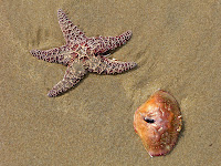
And then I see some other things on the beach, things that used to be alive, but now are not. And they come in on a wave, and arrange themselves on the beach. And so we go over and yes, we are doing "Still Life" camera work. One shot, another one to be on the safe side and then. . .we skitter out of the way of another wave. And this wave comes up and washes our still life away, back out into the sea. And So It Goes . . .


After about a half hour of this we decide to head on back. J. is on his way up to meet us and we don't want to miss our connection. And it is a long ways back there.

And so, with a few more glances, and one more dash into the cold surf to get our toes wet, we leave. We have been to the beach.

Thursday, October 16, 2008

The Oregon Dunes National Recreation Area

Journey to a Land of Water Wind and Fire

Part B: The Oregon Coast II d

Out to the Ocean

One of the main reasons I had booked us into a motel in the Reedsport area was because Reedsport also had the Visitor's Center for the Oregon Dunes National Recreation Area of the National Forest Service. I hoped I could get the type of information from them that I needed. This turned out to be a good decision on my part. But there is a story behind this:

I walked into the Visitor's Center on that morning of the 2nd day and saw three people behind the desk. Two guys, one youngish, one my age, and a woman probably in her late 40's and 50's. The young guy asked if I had any questions. I explained to him that I was interested in information about the Recreation area, but that he needed to understand I was a "retired" hospital chaplain who had spent more week-ends than I would care to remember working with families whose loved one, often their teen-aged son, would now be living the life of a vegatable as a result of an ATV accident. Accordingly, I didn't want any information on dune buggies, rides etc. which is most of what you see advertised. I was sure it was a "lot of fun' but not for me. Was it possible to go to someplace on the dunes and walk and not be bothered with all the motorized demons that are so frequently pictured? The young man said it was and showed me the two best places to go. I followed his advice, and I must say it was very good advice. But be warned, if your idea about a trip to the Oregon Dunes includes use of a motorized device, go elsewhere, you will not find any information on this site.

His first recommendation was for us to go to a location just south of the Carter Lake Campground and Boat Launch, on the Ocean side of US 101. It was entitled the "Oregon Dunes Day-Use" area. There he said I could walk to the Ocean as it was only about a mile through the dunes.


And so, after our lunch in Florence, we headed south past all the "sport vehicle" signs and soon found the Day-Use area. After changing into sandals, we joined others and walked out to the beach. The trail to the beach is fairly well marked out with poles along the way. This is good, because at the beginning, it resembles nothing so much as a scene out of "Lawrence of Arabia." I had feared we might get lost on our way out. However, I found my fears to be unfounded.


After the initial portion of sand, the trail dips into what is referred to in the "literature" as a "Tree Island." And this was my first surprise. I am used to an area of dunes being devoid of much in the way of plant life. Maybe some grass, a few shrubs, but not much else. Here in the Oregon Dunes, there are patches of forest all over the place. The trees within these forests are not huge, particularly by Oregon standards (and they grow them big out there), but they are not small either.


The trail came out on the other side of this forest into a sea of grass. I was unsure whether this was native grass, or if it was grass that had been planted at an earlier time when the idea was to "stabilize the dunes" so they wouldn't blow all over the place (this idea has been rejected in recent years, but the grass that had been planted was still everywhere).

(Note: the picture shows me attempting to make a cell phone call to my nephew. I have included it in order to warn any potential visitors out there, cell phone service on most of the middle part of the Oregon Coast is awful, at least for my service. They may advertize more bars in more places, and show Spain, France, etc. But trust me, in Oregon, there are few bars and fewer places.)


But we persevered and at last, in the words of William Clark "Ocian in View, Oh the Joy!"