Schedule of Arrivals

Saturday, January 31, 2009

McKenzie Pass Oregon

Journey to a Land of Water Wind and Fire

Part D: Central Oregon

Crossing the Cascade Mountains

Finally, the time came when we had to begin our trip home. And so, early that morning we left Bend and headed west to Eugene.

We had two options open to us in terms of making the trip, Santiam Pass and McKenzie Pass. We chose the McKenzie Pass (State Route 242) option. The maps and books had warned us it was not suitable for truck traffic (a real plus to my way of thinking), and other vehicles over 38 feet in length. Since we were driving a rented “compact car” I guessed that we would fit. It was also mentioned that the road was not open in the winter, but after all this was the end of August. Plus the books had mentioned the road was a mountain road that was filled with curves, but hey, I’m from West Virginia, that sounds like home.

We left Bend on US Highway 20 and headed to Sisters. We paused in this burg very briefly (mainly looking to see if there were per chance any items of railroad interest). But the longer we stayed, the louder we heard the siren call “Tourist Trap!” And so we left.

Outside of Sisters we found our turn, with a minor amount of difficulty (remember we are old fashioned and use a paper direction finder a/k/a a map). Of course, we were hardly 2 miles down Rte 242 when . . . that’s right. . . a truck passed us. Now, it was not a big semi-tractor trailer. Nevertheless it was a big truck. We both said to each other almost simultaneously, “I thought they weren’t allowed!” Oh well, we moved on (and passed them about 1/4th of the way up the grade).

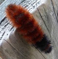
For the first part of the trip we felt like we were home in West Virginia already. And then we rounded a curve and saw something you never see in West Virginia. . . a field of lava rocks. We pulled over and got out and just looked around. There were rocks everywhere. And the road still was headed up, so we knew we were not at the pass.

And so we got in our car and drove on up through all the rocks until we did reach the pass. I already know the C.C.C. boys had built another “shelter” very similar to the one they had constructed out at the Cape Perpetua Scenic Area at McKenzie Pass. It was called the Dee Williams Shelter after a forester who had worked in the area at the time. I knew we would be able to stop there and get a better look.

A better look was definitely what we got upon reaching the turn-off at the head of the pass. We parked and A. went off to explore a trail that went out on the rocks. I, however, climbed up to the top level of the shelter to get a better perspective on all the Lava.

The Cascades have been, and will continue to be a very active, and interesting, part of the Pacific Ring of Fire. I had been to Mt. St. Helen’s and so the sight of lava all around was not new to me. Nevertheless, the sheer scope of it here at McKenzie Pass still almost overwhelmed me. Everywhere I looked, all I saw was black rock and sharp peaks.


Now standing here looking at the lava, and the string of volcanic peaks (for the record, the first one you saw was Belknap Volcanic Shield, followed by Mt. Washington and then followed by Mt. Jefferson) and surrounded by all this black lava, I knew for sure this one thing. Above all else, we had been traveling through a Land of Fire.

Tuesday, January 27, 2009

Cross Lanes West Virginia

The January Blahs

Well, it’s January. Thinking about Oregon last summer is fine. But this is January in West Virginia. And you know what that means.


Ah, and this year it seems particularly cruel. After all the “Obama-mania” of the transition and Inauguration, it is now beginning to set in. Change we have. The ideological purists of the right and their unthinking, unfeeling natures are out, for now. Replaced with, ever so slowly, the old, but re-emerging, coalition of the ideologues of the left, along with the sleaze of the center.

For example, when they put money for family planning for the poor in with an economic stimulus package, hoping no one will notice. Now, don’t get me wrong, yes there is a problem, and yes this is probably the best approach. But does that mean you put it in an economic stimulus package filled with “goodies” and pork-barrel for all so no one dares vote against it except he/she be tarred and feathered with the condemnation of those seeking to “re-build the economy”? Come on, if you have a program, and perhaps you do, be honest with yourself, oh, and yes, the American People who elected you, and put it in a bill where the merits of the particulars can be examined and not hidden among an evermounting mound of goodness for all.

And then, we have the case of the Treasury Secretary designee (as this is being posted he has now been sworn in) who can’t seem to remember to pay his payroll taxes. Oh, I know, “Mistakes were made. . . I’m sorry . . . I won’t do it again. . .” The theme of the 1990’s or as Yogi Berra might have said “Déjà vu’ all over again.” I suspect if one of us were guilty of this enfraction, well, there would be a different way to handle it starting with: “A lawyer in our Enforcement Division will talk with you about your options.” What’s next? An attempt to re-habilitate that outstanding preserver of state papers Sandy Berger?


Locally, things have been sad and grey around here. The local Avian Residents are mourning the sudden death, and disappearance, of John Q., “Red” Northern Cardinal, a resident of a nearby spruce tree. He was sitting on his branch happily singing away when the local Sharp Shinned Hawk swooped down and caught him. After a few hurried minutes of body preparation, with minimal distraction being provided by the local family of Blue Jays, the afore-mentioned Sharp Shinned Hawk flew away taking with him most of “Red’s” remains. Oh, foulness (fowlness?) of the deed!

An attempt was made to get a photographic record of the deed, but by the time the equipment had arrived, the assailant had swooped away (isn’t that always the case in these times). And so the C.S.I. crew was called in to record the “evidence” for possible future prosecution.


And now after 2 days of snow, the forecast calls for sleet changing to rain. And rain in such an amount, so now we have 3 weather advisories running, a “Cold Weather” Advisory, a “Winter Storm Warning” Advisory, and a “Flood Watch for both small stream and possible major water course flooding” Advisory.


Yes, it is the January blahs.

And then yesterday, as I went to the store to stock up between storms, what did I spy in the produce section? A small collection of those luscious delectable Red Berries of Hope:

Florida Strawberries.


Yes, they were finally here. And so I got a quart and we had some last night with cake and strawberry yogurt. And as I sat there tasting the sweet but tart goodness (and none of the straw that I get with California Strawberries that make it to our stores), I thought:

“Can Spring Training be Far Behind?”


Ah, another month of this blah-ness and then its out to see the crack of the bat, the sound of the fast ball smoking into the catchers glove. Another month of all the shades of grey associated with "this season" and then begins the speculation that most of us live for: What are the Pirates going to do this year (yea, our local team finally has an affiliation that makes sense)? And don't forget, what about the Reds? And of course, remember your roots, what about the Nationals?


Ah, sweet berries of kindness, sweet berries of spring.

Sunday, January 25, 2009

Central Oregon

Visit to a Land of Water Wind and Fire
Part D: Central Oregon
The Cascades Lakes Scenic Highway

We finally managed to tear ourselves away from the Newberry National Volcanic Area. I had only scheduled us into this area for the shank end of our day coming in from Crater Lake, and the next day. And there was more we wanted to see. In particular, we wanted to drive the Cascades Lake Scenic Highway.

And so we left the Newberry Volcanic area and crossed over to the other side of US 97 and set off for the Cascades Lake highway. Now you have to understand that to date, we are still the "old fashioned" car travelers, meaning we do not have one of the GPS doo-dads that shout out directions, yell at you when you make a wrong turn, and otherwise let you know that it is far smarter than you. No, we still use a map (my how quaint!). And so, on our way over. . .we took a wrong turn.


But hey, in this country, you can take a wrong turn and even so have a good time and see spectacular scenery. And so it was, that when we should have turned left, . . . we turned right, and lo and behold several miles down the road found ourselves at the Falls River Fish Hatchery. But as I indicated, so what, we still had a good time.


Now, don't get me wrong, fish hatcheries are not really my "thing." Plus, I have been to several fish hatcheries here in West Virginia. So it wasn't the fish in the hatchery that made the stop for me. It was, rather, a very pretty, full flowing Fall River that was filled with some of the clearest, and coldest, water I had ever seen in a river. To find out how cold it was, I even stuck my hand in it. And believe me, you would never have believed it was the end of August! The water was that cold. And so J. and I walked up and down the river for a few minutes (A. stayed back at the car).


Once we got back to the car we got out our "trusty" map, figured out where we had gone wrong and proceeded to turn around and go back towards the Cascades Lake Scenic Highway. Finally, after passing where we had made our wrong turn and traveling on a bit further, we hit "paydirt." We were on the Cascades Lakes Scenic Highway.


I had figured on stopping at 3 points. As it was we ended up stopping 6 times. Unfortuantely, our first stop, Osprey Point, was a big disappointment. There was a trail there that led out to a lake. And there were supposed to be Osprey (hence the name) and other birds around. Well, we did see a platform that could have held an Osprey nest at one time, but if there had been a nest (and it looked doubtful that any bird had nested there for several breeding seasons) it was unoccupied at present. Well, I am sure that the end of August is not the right time of year to see Osprey nesting in these parts. However, contrary to our expectations, we saw few other birds. Oh, there were some gull-looking creatures, but we were far away from them. And so, after a few obligatory snap shots, we all moved on.


Our next stop was at the Little Lava Lake Campground. Little Lava Lake is reportedly the source of the Deschutes River. And since we had seen the Deschutes where it flows into the Columbia on our way in, and since Bend itself is located along the Deschutes and we had seen the river as it flowed through town, I thought it would add a nice touch to see where it began (over to the left in this photo).


As the day was moving on, we drove on down towards Mt. Bachelor and made a few quick stops for photos. One stop, in particular, was made in order to get a good shot of this famous ski slope. But really, Mt. Batchelor may be a great ski area, however as a scenic mountain, well, I've seen a lot better, both on this trip and in other places.


We finally stopped at the Dutchman's Flat area, just to the north of Mt. Batchelor. J. and I took off on a trail down to Dutchman's Flat. The trail doubles as a Cross Country ski trail during the winter months. Consequently, as we walked along the trail we saw many long, 20-30 foot tall poles on either side. These poles were, as J. noted, markers used by skiers in the winter. The tremendous amounts of snow in this area dictated that the poles be as high as they were. While he had never been here to cross country ski, J. assured me he had seen pictures of this trail and in those shots these "poles" appeared at times to be only about as tall, or a little taller, than the figures on the trail.


At any rate, eventually we came out on Dutchman's Flat which proved to be a bare spot, probably more
pumice desert such as we had seen at Crater Lake, with this wonderful-looking mountain as a backdrop. This mountain is called Brokentop. Obviously, it was of Volcanic origin, as most of the rest of the area was. And obviously, here too, the events surrounding its creation were a bit "unusual" to say the least. This seemed to be an emerging theme of this trip.

Thursday, January 22, 2009

Newberry National Volcanic Monument Oregon

Journey to a Land of Water Wind and Fire

Part D: Newberry National Volcanic Monument

Glass Stones


This stop in the Paulina Peak section of the Newberry National Volcanic Monument was, for me, probably the second highlight of our trip (Simpson Beach at Shore Acres State Park being the first highlight). In doing my research about Central Oregon I had read about the Obsidian Flow, and as noted in a previous post, I had seen it from “up above” (Paulina Peak). But this is where I got out of the car, and with J. as my companion, set off to explore the area.

The flow towered above us as we approached, I estimate it was probably as tall as a 4 or 5 story building above the floor of the Newberry Caldera. As I paused to look at it (that is Paulina Peak, our previous stop, in the background), I marveled. Then when I read some of the interpretative signs along the trail, I was even more in awe. The flow is made up of 3 kinds of rocks, Obsidian, that is to say almost pure glass, Grey Pumice, and White Pumice. Of the 3, the Obsidian was the most unusual to say the least.

It shined in the sunlight, almost as if someone had come by with a “shining cloth” and brightened it up for a military-type inspection. I was never known in the military as a “fastidious dresser” per se (I always figured if it was good enough for U.S. Grant, it was good enough for me). Thus, shining shoes were never my forte (I was more noted for my muddy boots which I wore with pride because I got them visiting with the troops). Thus to say that these rocks would have passed my inspection is not really saying very much. But trust me, the rocks were very bright and shiny.

Obsidian was very valuable in the life of the Native American tribes in this area. They used to come to here to gather the obsidian once a year or more. After they had collected the rocks, they would form them with their crude instruments into sharp heads for their arrows. Sometimes these arrow heads were for their own arrows, at other times the arrowheads became a “medium of exchange” which they used in their trading activities. As we were walking through a particularly glassy area where the trail went over obsidian that was actually fines particles of glass (signs caution you to wear sturdy shoes on this trail, not sandals, flip-flops, or tennis shoes), J. remarked to me: “Just think, Native Americans used to come up here with nothing more than hide moccasins to protect their feet. I bet they suffered a lot for their collecting efforts.”

Obsidian is still valuable today for the same reason it was valuable to the Native American tribes. It provides one of the sharpest edges known today. It is used in several different types of applications involving cutting. For example, some medical tools used to make surgical incisions, have obsidian cutting edges. It is also a popular stone used in for various decorative purposes. Needless to say, if you search the net for Obsidian you will find that many of the entries are for businesses that are selling the stuff, mostly to jewelry makers. For this reason, several signs throughout the area cautioned visitors to look and enjoy, but do not take a “souvenir” it is government property.

The other 2 kinds of rock in the area were white and grey pumice.

The white pumice stood in sharp contrast to the rest of the rocks around it, and was easy to spot.


Pumice (both the white and the grey) is “frozen volcanic foam” (see: http://www.fs.fed.us/r6/centraloregon/recreation/trails/3958a-obsidianflow.shtml). This means it is filled with many small pockets of air. Accordingly, big boulders that would appear to be very heavy are, in fact, very light (as J. is showing here).

This was not the first time we had seen this. J. had been with me on the Johnson’s Ridge Observatory at Mt. St. Helen’s in Washington. We had both been impressed when one of the Ranger/Guides there picked up a very large stone and batted it around like a beach ball. He explained to us that many of the rocks in the Cascades region are exceedingly light because the Cascades are very “gassy” volcanoes. Thus, many of the rocks they leave behind, particularly pumice (which as noted above is nothing more that foam that has cooled), are very light. Since that experience, I have seen several other pictures taken in the Pacific Northwest, and according to one guide I read, it is a “favorite Kodak moment” for many visitors to that area. So consider the above another “Kodak Moment.” And if you every get out that way, maybe you too can impress your friends back home with your demonstrated strength.

Of course, there was some vegetation up on this flow. But it was all very precarious, and obviously it was and is tough for plants to survive in this environment.

As I said at the beginning of this post, all in all, I was impressed, and so were my companions. I would definitely recommend this area to anyone wanting to visit in Central Oregon.

Tuesday, January 20, 2009

Washington DC

Inauguration Day


Once again, and just as we are getting to another high point in our Oregon trip, I pause in my recounting of our Journey to a Land of Water Wind and Fire, to become a bit more “contemporary” and discuss a “current event:” Inauguration Day. Only, for me, Inauguration Day is not a National or International Event, rather it is for me, since I grew up in the town, a local event. And so, I wish to present a few “observations” or memories of what this day has meant to me through the years.

First off, I wish to have everyone reading this posting remember, that for me, as for countless other Americans, the current site of the Inauguration is not the site of my youth. No, for me, and countless Americans who lived between March 4, 1837 (Martin Van Buren’s Inaugural) and January 20, 1977 (Jimmy Carter’s Inaugural), the actual “changing of the power” (i.e. the swearing in ceremony) occurred on the East Side of the Capitol Building, in an area referred to by the Architect of the Capitol office as “The East Portico.” (Those of you who wish to have a recount go to: http://inaugural.senate.gov/history/chronology/index.cfm )


The change to the West Front probably occurred in recognition of the fact that Washington DC had become a changed city by 1981 when Ronald Reagan took office for the first time. Back in Van Buren’s time Washington was a small city. Only a few people lived there. And those who did, lived to the East of the Capitol, in the area known then, and now, as Capitol Hill. Today, we look out to the west and we see grass, monuments, museums, cars, and, of course today, a sea of people. But back in 1837, what one saw was swamp, mud, a slow-moving canal, and a bunch of small houses, many of some questionable character. Indeed, according to some historians, during the Civil War era (1861-65) a large part of the area between the Capitol and the White House was given over to “The Red Light District.” Also even before the War had started, railroad tracks ran across the mall connecting the Baltimore and Ohio Railroad with the roads leading south (via the “Long Bridge” which was eventually replaced by what we called the “14th Street Bridge when I was a kid).

So today the view out the West is much better. It certainly is more dignified, and not as "smelly" to boot (though with the Inauguration in the Winter, the smell associated with swamps is rarely a problem). Plus, with the whole slope of the land, it lends itself to allowing more people to participate. This increased visability may even have been in the plans of the Architect of the Capitol when an extension to the West Front was made in the 1890's.


And thus, today, President Barack Obama took the oath of office on the West Front (or “Portico” as the Architect of the Capitol calls it).


But enough of that, what about my memories of Inauguration growing up?


The first Inauguration I remember was the Truman-Barkley Inaugural in 1949. What I remember most was the fact that my Dad, my sister, and I went over to a friend’s house who lived in Southwest DC near where the Inaugural Parade lines up. We spent the morning walking past the various floats that were receiving their “last-minute” touch-ups. We got much the same view of the 1949Inauguration Parade that my grandson did recently of the 2008 Macy's Thanksgiving Day Parade.

On my other site, A Collection of Railroad Stations, I recount my most vivid memory of the 1953 Inauguration. My only additional memory was that we had to go over and pick-up my grandparents and bring them over to our house for dinner and then get them back to their home. Now, that might seem an innocent task, to be sure, except my Grandparents lived in the 100 Block of C St. NE. The house no longer exists, it was taken over by the Capitol Architect’s Office and part of the Hart Senate Office Building occupies the site.

By 1953 my grandmother was in very poor health, indeed she would die only a few years later. In particular, by this time she was having trouble walking. Thus, Dad had to co-ordinate our movements carefully. I remember that we drove over as far as we could on C Street and found a place to park. Then Dad walked on down about ½ block to where there was a uniformed Marine. Dad explained he had to go get his parents and bring them out of the area to our car. The Marine let him go, and as Dad brought his parents out, the Marine, seeing the situation apologized and said if Dad could delay our return until 4 o’clock, then he would be able to drive right up to my grandparent’s house.

The 1957 Inaugural Parade is the only Inaugural Parade I ever saw in person. We had seats in one of the buildings lining the route. Our location was just where the parade leaves Constitution Avenue and turns onto Pennsylvania Avenue. At that time, there were still streetcars in DC. Thus Pennsylvania Avenue had streetcar tracks running down the middle of it. One of the state floats, I believe it was Louisiana, consisted of a big platform with a band seated on it playing, pulled by a 1957 version of a truck cab. As the platform turned onto Pennsylvania Avenue, it got stuck on the streetcar tracks. Several following floats had to “detour” around the stuck float, but they eventually got everything moving again. Streetcars were already on their way out of DC’s “life” (thanks to a certain Congressman from Michigan), but I suspect this incident hastened their demise, and the removal of their tracks from Pennsylvania Ave.

My most vivid memory of the 1961 Kennedy Inauguration was that the city of Washington was paralyzed the night before by a snowfall that exceeded 10 inches. I had been at a basketball game at Eastern High School that night, and the trip home, which normally took 30 minutes to an hour at the most, turned into a 4 hour marathon, as all the snow moving equipment was taken from the streets and applied to the parade route. They even brought in Army Flame throwers to dry the route off. The next day, Inauguration Day, we were "snowed in" at our house, and along with millions of other Americans watched on TV as the cars and the officials, and the bands, floats etc. all paraded by on a nice, clean, dry street with only a hint of snow anywere. In other words, the televised ceremony seen by millions in 1961 (and via re-runs by countless others since then) bore little resemblance to the reality for most people (but then, a lot of the Kennedy Administration was like that).

And that brings us down to 2009. No, I didn’t go there today, except on TV. But A. and I did walk by the Capitol in December. We were on a stop-over in DC waiting to catch our train back to WV. And we took a walk around the Capitol. And when we got to the west side what did we see?

And then we saw the actual construction as well.


Well, so much for memories of DC and Inauguration. Next time, I promise, the Pumice Field at Newberry National Volcanic Monument.

Friday, January 16, 2009

Newberry National Volcanic Monument Oregon

Journey to a Land of Water Wind and Fire

Part D: Newberry National Volcanic Monument

A Peak Experience

Early the next day we met up with J. and headed back down Rt. 97 (it was better this morning), to the Paulina Peak area of the Newberry National Volcanic Monument. J. had talked a lot about this area being a “High Desert.” But somehow it did not look like a desert to me, there was an awful lot of water, and trees as well. Then he told me the moisture that does come, comes in the winter (I bet right about the time this is being posted) in the way of snow. Ah, that made sense.

We turned off of 97 after about 8-10 miles and headed east towards the Paulina Peak area of the Monument. I knew that this whole area was another caldera, just as Crater Lake had been a caldera. But this caldera turned out to be vastly different.

How different from Crater Lake became obvious as we reached the “rim” of the caldera. A sign beckoned us to turn off to the left for the Paulina Falls.


According to the rangers at Crater Lake, Crater Lake has no inlet or outlet. Water that falls into Crater Lake, largely in the form of snow, stays in Crater Lake, except for some evaporation, and leakage into the groundwater system. There is one falls, Vidae Falls, and a couple of springs fed by groundwater but they are not considered direct outlets from the lake.

But things were different at the Paulina Peak caldera! For these falls are the result of water was flowing out of Paulina Lake which is within the caldera. And even on this day, during August, the dry season, the water was flowing freely. And from the "trash" left behind, it was obvious in the spring the flow is much greater. Suffice it to say the water doesn't stay in this caldera.

Leaving the falls, we re-entered the main road into the caldera, went a ways, and then turned right and climbed the steep dirt road up to the top of Paulina Peak. I must say, the drive to the top on this road reminded me of the day A. and I drove to the top of Spruce Knob WV (the tallest mountain in WV). But unlike Spruce Knob, where we were at 4,863 feet, here at Paulina Peak we were much higher. “How much higher?” You may ask. This much higher:

Well, needless to say, I climbed up to the very topmost rock and looked around in the Caldera.

First, I saw a lake (I actually saw two, but I got a better shot of the first one, Paulina Lake):
And then I shifted my gaze eastward where I saw this mass of blackish looking rock, looking ever-so-much as if someone had taken a load of dark gravel and just dumped it on the floor of the caldera.


Tuesday, January 13, 2009

Newberry National Volcanic Monument Oregon

Journey to a Land of Water Wind and Fire

Part D: The Deschutes River Valley

Lots of Lava

After a rather scary trip up US Route 97, we finally arrived in the Newberry National Volcanic Monument area. We had already determined that since this first day was only a “partial day” we would go to the Visitor’s Center and see what they had to offer.


The Visitor’s Center itself was very nice. However, with only a few hours before closing left we opted to go straight for the trails (particularly since I had already been to their site on the Web). On our way in we saw the “lava butte” and also a glimpse of what else was in store. So after a few minutes devoted to “checking in” we headed for the Lava Land trail.


One of the first stops we made on the trail had the following sign:


Now as one of many of my generation who stayed up until 3 AM the morning Neil Armstrong walked on the moon for the first time, I was impressed with the idea that I was, in a very loose sense, following in his “footsteps.” And, the more we walked through the area, the more I began to realize that for once NASA probably had gotten it right. I have seen many of the pictures the expeditions to the moon had brought back, and you know, it did look kind of like what I was seeing. So this was a good training ground.


There were a few sparse plants around trying to make a “go” of it. But overall, the impression one received was that you were completely surrounded by rock, dark black rock. Yes, we were definitely on something that was close to a “moonscape.”


I have been many places in my lifetime, and experienced many different types of topography, but this place was truly different.

Saturday, January 10, 2009

Mt. St. Helen's Washington

Journey to a Land of Water Wind and Fire

Part D: The Upper Dechutes River Valley

An Interlude

We are now on the road to Bend OR. But before we get there we have a few stops to make, and a few thoughts to share.

Wednesday, January 7, 2009

Crater Lake National Park Oregon

Journey to a Land of Water Wind and Fire

Part C: Crater Lake

Crater Lake Farewell

Tuesday, January 6, 2009

Crater Lake National Park Oregon

Journey to a Land of Water Wind and Fire

Part C: Crater Lake

Crater Lake Re-visited


Once more let us return to Oregon and the site of so many wonders. When last we were there, several postings ago, we were at Crater Lake National Park. And so, we return there once more.


On a map, it appears to be simply a lake with a road around it. But it is more, much more.


It is a land of water, blue water, clear water, and yes even pure water. Water that has gathered for over 7,000 years, and presents itself as water should be. A calm pool in the aftermath of a series of destructive blasts.


But wait, there is even more.

For as the day fades and turns into the inky blackness of night, there is one last “Hurrah” in store for those who dare to see. The light casts a reddish glow upon the ragged cliffs above the blue pool.


And then, especially after a day of clouds and rain, there is that last burst of the sun, letting one and all know that, in the words of Dylan Thomas, it is not going softly or gently into that good night.


Sunday, January 4, 2009

White Sulphur Springs West Virginia

For Sale:

One slightly used, but historic, luxury hotel located in the beautiful Greenbrier Valley. It was rumored at one time to actually be an island, but that ephemera has now ended. Buyer must be willing to assume all the assets and liabilities that go with it including years of neglect from an owner that really does not know what to do with it (or anything else it owns). Clients of Bernard Madoff need not apply, your credit score will not be high enough for us.
For more information contact: Goldman Sachs

On a more personal note: A. and I stayed at the Greenbrier recently and we are not surprised at this action. Aside from our group (many of whom were not actually staying at the hotel) and a few bus groups composed of GrandMa and GrandDad in for a day with the Senior Group from East Cupcake Maryland, there was hardly anyone else there. I mean, it was nice to take a mid-day swim in the pool and only have 2 or 3 other people in the water, but that does not bode well for the bottom line.

Further, when we de-trained from the Cardinal, the hotel (which after all still owns the White Sulphur Depot and uses it as a Christmas Shop), did not even have the lights on. And even though it was only 6 PM, this being early December, it was very dark. Apparently, the staff knew about the situation and had reported it, but management did nothing because when we left 2 nights later at about the same time, the lights were still off.

Thursday, January 1, 2009

New York City

Christmas in New York

I have been away for a while. You know how it gets around this time of year . . . And with family in New York City. Well, you understand don’t you? . . .

It was cold up there, trust me. Nevertheless, we went to the center of New York’s Christmas, the skating rink at Rockefeller Center.


And of course, what would Christmas in New York be without viewing model train displays. We saw two of them:

The one at Citigroup Center (they say this is the last year for this one, another casualty of the Recession/Depression).


And then the one at the New York Botanical Gardens. This one was enlivened by the building models made out of plant materials.


Another day we went to the Bronx Zoo where we saw winter animals, such as this snow leopard, in their true element.


But hanging over all the festivities of the season was the specter of what has happened on the financial markets. And no, before you ask, we did not see the mastermind of “the greatest Ponzi scheme ever.” But we did see the building he worked out of. It is called "The Lipstick Building" and to my way of thinking, it is aptly named. It reminds me of the "old" saying: "Even if you put lipstick on it, it is still a pig." Now in this case, I am not talking about political beliefs, but financial ones.


For more “coverage” of this event, see the “Best Blog on the Net.”

Concluding personal note: Yesterday would have been John M.’s 99th birthday. Happy Birthday Dad.