Schedule of Arrivals

Tuesday, September 30, 2008

Lighthouses in Oregon and Elsewhere

Journey to a Land of Water Wind and Fire

Interlude: A Potpourri of Lighthouses

This blog is dedicated to all those who are "Lighthouse Fanatics." I don't know exactly who you are, nor do I know why you think like you think . . . I just know you are out there. Like my older sister and the clock she has in her kitchen, you are poised and ready to look at whatever lighthouse might come along.


Now I admit most lighthouses are rather nice to look at, tall, slender, and poised on many days against a bright blue sky. And I know that at one time they were very functional, particularly when the sky wasn't all bright and blue. But the extent to which some carry it. . . I don't know. Further, I know there is a lot to them beyond the architecture, something about lenses and candle power which I little understand and hence will probably not bother to include. Anyways, here they are:


The first one we saw was the famous Chicago Lighthouse at the entrance to the harbor to Chicago (of course). This is one of the few lighthouses that we have actually "used." We sailed past it in September 2005, when our Great Lakes Cruise ship entered the Chicago Harbor in order to dock at the Navy Pier. Our view of it on that day was somewhat obscured by an early morning haze that streamed out towards us on the lake from the city of Chicago. Obviously, on the afternoon we were there on this trip, haze was not a problem.


We also saw, at a distance, a lighthouse in Milwaukee WI. But we never got close enough, nor was the weather ever clear enough, to allow a decent shot of it.


And so we move on to the subject of the rest of these shots, the Lighthouses of the Mid-Oregon Coast. They were 4 in number.


The first Mid-Oregon Coast Lighthouse we saw has been dubbed by some of the tourist literature as "the most photographed lighthouse in America (O come on now, what about Cape Hatteras NC ?)." It was the Heceta Head Lighthouse. The Heceta (pronounced by the locals as "Heh-see-ta") Head Lighthouse has been rated as "the strongest light on the Oregon Coast" (the Oregon State Parks brochure didn't say by whom). It is sited 205 feet above the ocean and is a 56 foot tower with an adjacent building. It was first "illuminated" (i.e. the light went on) in 1894. The Assistant Lighthouse keepers house (built in 1893) is now a Bed and Breakfast, but we didn't stay there. The shot we took was from the far end of the Devil's Elbow State Park. Heceta Head is located about halfway between Cape Perpetua (see I told you we would leave there sooner or later), and the town of Florence (more on this burg in a later posting).


The next light we saw was the Umpqua River Lighthouse located just to the west of the town of Winchester Bay(more on this town in the next posting). While there is a state park with the same name nearby, the actual lighthouse is located on a small, still functioning US Coast Guard station. An earlier structure in the same spot was erected in 1857 and was the first lighthouse on the Oregon shore. The current 65 foot structure was "illuminated" the same year as the Heceta Head Lighthouse, 1894. Given the closeness of the dates of construction, it is not surprising that the Umpqua River Lighthouse is almost a complete copy of the Heceta Head Lighthouse shown above. While the county maintains a museum in the structure and tours are conducted there, the lighthouse, as I said, is adjacent to a Coast Guard station and is surrounded by Government Issue housing.


The next lighthouse is somewhat mis-named IMHO. It is called the Cape Arago Lighthouse. But we went to Cape Arago and saw no lighthouse (see a later posting). Instead, we found that the "Cape Arago" lighthouse is located about 2-3 miles north of the cape on an islet just off Gregory Point (so why didn't they call it the Gregory Point Lighthouse?). It was the newest lighthouse we saw. It was "illuminated" in 1934. Even though it is only 44 feet tall, the cliff it sits on is 100 feet above the ocean. Thus, I suspect it is very visable. It does have a very unique sounding fog horn. I realize now I should have shot a "movie" of this scene so that I could have captured the sound. (But I am still new at the "game" of blogging.) Sorry.


The last lighthouse we saw was the 40 foot tall Coquille River Lighthouse, across the Coquille River from the town of Brandon. It was "commissioned" in 1896, but my source did not say when it was "illuminated." It was later de-commissioned in 1939, and restored as a museum and interpretative center in 1979. We had hoped to get shot of this structure from the front, but, as you will see when I get to the Brandon posting, the weather moved in on us very badly and cut short our stop in that town.


There, you have it. The lighthouses we saw. I trust this posting has been "illuminating" to say the least.

Sunday, September 28, 2008

Cape Perpetua Scenic Area Oregon

Journey to a Land of Water Wind and Fire

Part B: The Oregon Coast I h

Others Have Been There Before Us

Before we "leave" Cape Perpetua (yes, the next posting will not be about this area, after all, we saw a lot more of the mid-Oregon Coast), let us "tip" our hat to those who went before us.


First, we must recognize the man, and his crew, who gave this area it's name, Captain James Cook, and his band of explorers. According to one account, they passed the Cape on March 7, 1778, St. Perpetua's Day, and named the Cape after this early Christian Martyr. Then, I also heard that they had to take refuge in the area around the Cape from a winter storm and thought they would be there perpetually (but I could find no "net" backing for this idea so perhaps it is just another "Urban Legend"). At any rate, everyone agrees Captain Cook gave it it's current name so we must remember him, and his crew. One way this has been done by the National Forest Service is by naming the primary trail down to the coast at the Visitor's Center after Captain Cook.


The next group to remember were the Alsea (or Alsi depending upon which source you are using) tribe of Native Americans. They visited the site for almost 1300 years before they were driven away by the early settlers in the middle of the 19th century. However, they left behind part of their settlements in the form of their "trash piles." As they harvested the various shell fish from the waters around the Cape, primarily Clams, they left the shells heaped up on the beach. The resulting mounds, called "middens" can still be seen along the Captain Cook Trail today.


The third group to remember were the boys of the Civilian Conservation Corps (CCC) who had a camp here at Cape Perpetua throughout the 1930's. As West Virginians, both of us are very familiar with the work of the CCC's since they did a lot of work in our area of the world. Also, one summer A.'s father did a tour of Reserve Army duty with the CCC camp in the area we now know of today as "Blackwater Falls State Park." He led a group of boys as they planted trees in that area to replace the ones that had been clearcut by the loggers in the latter part of the 19th and early part of the 20th Century.


Shortly after the start of the Captain Cook Trail there is a wall that the CCC boys originally built to provide a level place for their camp. Evidences of the camp itself were not readily visible, but the wall is still there right beside the trail.


Also in this area of Oregon, among other things, the CCC boys built a shelter up on top of the Cape that still serves as a lookout point.

Saturday, September 27, 2008

Cape Perpetua Scenic Area Oregon

Journey to a Land of Water Wind and Fire

Part B: The Oregon Coast I g

On a Clear Day . . .

But despite all the raving about the surf, and the rocks, and the waves, and the Tidal Pools and the trees, Cape Perpetua Scenic area is best described in the AAA Oregon Tour book as: "the highest point on the Oregon Coast accessible by car."

In short, "It is the view, dummy. . .," that people come here for. And on the day we were there, it was quite a view. We were 800 feet above the sea level at that point, and maybe we didn't see the 70 miles of Coastline that you are supposed to see on a clear day, but I suspect we came pretty close. When I took the shot above, I was looking south from the top of the Cape.

Now, you don't have to drive up to the top of the Cape. For those who are avid outdoors people, there is a hiking trail to the top, the St. Perpetua Trail. It is 2.6 miles round trip. The first leg is UP, and the last leg is DOWN. But given our age, the type of trip we were on, the fact that this was our first day "on terra firma" after 2 solid days of rockin' on the rails, plus the fact that there were other places we wanted to see, we drove up parked in the lot at the top. Then we took the loop trail (The Whispering Spruce Trail) out to the overlook points.

After traversing a short way through a Sitka Spruce Forest, we came out upon the view shown at the top of this posting. We also paused to look at the area right below us, where we had been earlier and seen the surf.


On our way down, we found the one overlook where it is possible to look to the north, to the town of Yachats (pronounced, I understand, Ya-hots) and a little ways beyond.

It may have not been a completely clear day, but it was the clearest day of the 3 we spent on the coast. And we were certainly fortunate that it was the day we came to this spot on the coast.

Friday, September 26, 2008

Cape Perpetua Scenic Area Oregon

Journey to a Land of Water Wind and Fire

Part B: The Oregon Coast I f

Up Close and Personal -- Part II

And down there in person, you get a different sensation as you see the surf foam being heaved up and down by the incoming tide, (Note, the blue streak that enters the camera view from the left twice momentarily, was my camera strap. I told you it was windy did't I?)

Cape Perpetua Scenic Area Oregon

Journey to a Land of Water Wind and Fire

Part B: The Oregon Coast I e

Up Close and Personal


Well, sports fans, as they say during the Olympics (the games not the National Park or the Mountain Range both of which are in Washington State) "Let's get up close and personal" with this surf. Now, use care, to be sure, for the tide is coming in. So, our fearless reporter, ever envious of A.'s new camera with its 10X Zoom function, decides to go up close in person.


And the effect not only leads to a different type of shot, but also a different experience. For here I saw the surf in all its different moods.


I saw waves being channelled into breaks in the rocks.


I saw Tidal Pools being gradually being overcome by the incoming surf (and thus allowing the life within them to live and prosper).


I saw large pockets of foam churned up by the sea gathering in the various pools and puddles formed in the rocks by countless poundings of the surf through the years. (More on this in the next Posting.)


And let us not forget, there is that unique feature of this area, a spouting horn, often called a "geyser of surf." Now a geyser is defined as a natural hot spring that shoots up water on a periodic basis. The most famous one, of course, being "Old Faithful" in Yellowstone National Park (which A. and I watched many years ago in a blinding late May snowstorm) in Wyoming.


A spouting horn is where a geyser-like spurt of water occurs where the rocks are formed in such a way, that as the waves come in spurts of water are pushed up into the air. Cape Perpetua has one of those phenomena, it is called "The Devil's Horn." And it is quite a sight to see as the surf comes in, and the spurts grow in height and in volume with each new incoming wave.

Thursday, September 25, 2008

Cape Perpetua Scenic Area Oregon

Journey to a Land of Water Wind and Fire

Part B: The Oregon Coast I d

Watching the Surf Roll In

To really get an appreciation for the power that we were seeing, it might help to view the video footage I shot at Cape Perpetua that day. Because the tide was coming in, and we had been cautioned that the waves are very unpreditable particularly on an in-coming tide, I was back aways from the shore. Nevertheless, I hope you can get a sense of what we were seeing on that day. And remember, this is the summertime when it is supposedly "calm." This is not the middle of a winter storm. I don't know if I could take that experience.

Wednesday, September 24, 2008

Cape Perpetua Scenic Area Oregon

Journey to a Land of Fire Wind and Water

Part B: On the Coast I c

Riding the Surf


As you may have figured from the previous video, there is something more to the Cape Perpetua area that just a big rock sticking up over the Coast. There is also a lot of surf. Now this is not the surf where the waves come rolling into a sandy beach with surf boards, wind surfers, bikini babes etc. Rather, this is a place with a rough surf that pounds in upon a shoreline composed of solid rock with a volcanic origin.


And yet, that is part of the appeal of the place. For here you can simply watch the water pound its fury out upon these rocks. And as violent as it may seem in the "summer" you can only wonder at the fury expended in the winter during the infamous storms that regularly hit these coasts.

I had originally hoped that we would be able to explore some of the tidal pools in the area. I had explored some of tidal pools up on the Washington State Coast in the Olympic National Park and was looking forward to sharing a different form of this experience with A. But it was the wrong time of day. Despite our early start, we got there after 12 noon, and the tide was coming in. So, we were advised not to get too close to the tidal pools since the tide would be completely in about 4:00 PM. (The moral of this is: check with the Hatfield Marine Science Center for the Tide Schedule when planning a trip to this area.)

We had no choice we had to be content to simply watch the tide come in. But did it ever come in. And the show of it coming in was worth the trip!

Thus, making lemonade from lemons, we decided to take a closer look at just how the tide comes into this rocky coast line.

Tuesday, September 23, 2008

Cape Perpetua Scenic Area Oregon

Journey to a Land of Water Wind and Fire

Part B: The Oregon Coast I b

I tried once again today to upload the video I shot of Cape Perpetua and the surrounding ocean. The first time, it did not take. But I persevered and the second time:

The sound you may be hearing is roaring in the background. Some of that is from the surf, and some of it is from the winds. And with that, there is a story.

For some years now, I have tried to give a "Title" to all of our travels. I picked up this habit from taking several W&M Alumni trips. It is something they do. Anyway, I originally entitled this trip "Journey to a Land of Water and Fire." However, after spending 3 days on the coast in constant wind, and another 3 days of wind up at Crater Lake, A. said: "You know we need to ask J. if it is always this windy out here." Well, we did, and basically his answer was "Most of the time." So, I changed the name of our trip and added "Wind."

Monday, September 22, 2008

Cape Perpetua Scenic Area Oregon

Journey to the Land of Water Wind and Fire


Part B: The Oregon Coast I a


We left Eugene the morning after our arrival and drove over to the coast. At Florence we turned north because we wanted to spend as much of the day as possible at the Cape Perpetua Scenic Area. The area is part of the Suislaw National Forest. I had read a lot about the Cape, and I must say, I was not disappointed in our visit there.

I had hoped to present a Video in this blog that I took of Cape Perpetua and the ocean. However, it was "in processing" for over 25 minutes. So I will forget that for this posting. Instead I will present a Panorama of almost the same view as the Video.

Both pieces were taken from the Captain Cook Trail which runs between US 101 and the Pacific Ocean.

Sunday, September 21, 2008

Great Train Stations in North America: 5

Amherst Virginia: Southern Railway

When you visit some train stations you just know you will never see them again. Mainly because you know they will not be in that location much longer. You know they will either be torn down, burned down, or moved. Only occasionally when they get to be this bad do they get to be "restored" and turned into something like a restaurant or Visitor's Center. Thus, you realize this is a once in a lifetime stop, and you are not sad about that situation. For this is a station you really do not want to come back to.

So it is for this station we found one day in Amherst Virginia just to the north of Lynchburg Virginia. It was an old Southern Railway Depot that was obviously on its last legs. It still sat on Depot Street beside the active Washington DC to Atlanta Mainline of the Norfolk Southern Railroad. At one time it was no doubt busy with passengers boarding and de-boarding from various passenger trains, maybe even the fabled Crescent. But now Amtrak's Cresent passes by about mid-night with nary a nod to this old station.

Surely, sadly, I suspect its days are numbered and soon will be no more. And thus, I will not see it any more.

The Coast Starlight

Journey to the Land of Water Wind and Fire

Part A: Getting There IV

Through the Willamette Valley to Eugene


The Coast Starlight was pretty much on time coming down from Seattle and we boarded it and left promptly at 2:25 PM. Almost immediately we crossed over the Willamette River on the same bridge we had seen on our walk (see the last post), and curved South to begin our Journey down the Willamette Valley.


Even today with all the urban sprawl in the country, the Willamette Valley remains fairly "agricultural." I use that word advisedly because according to what my nephew John O. says, the largest "cash crop" in the Willamette Valley these days is Grass Seed. We had noticed a lot of hay fields on our trip down and John says that they gather the hay only after they have gathered the seed. The hay, by the way, is used to feed a collection of livestock, both within the Willamette Valley and also in other parts of the state.


Whatever, to me the important thing I had to remind myself was that when the Pioneers trudged across the Oregon Trail to take up "new Lands" in Oregon, they were hoping to settle in lands such as the Willamette Valley. And yet, as we both knew from our early morning travels, much of Oregon is a desert and not nearly as fertile as this narrow valley.


At last, we arrived in Eugene Oregon, our "final destination" of our westward trek. I had called the Hertz car rental place while still on the train and they came over to the station and picked us up about 20 minutes after we got there. We then made the arrangements for "our" car for the next week and drove to our Motel. As I sank into the bed that night, I knew we had arrived.


Concluding Unscientific Postscript


You may be asking yourself, "Why did they pick Eugene as the base from which to begin their tour of Oregon?" Very simply, it was the closest I could get to the various areas we desired 
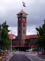
to tour, and could find "support" (i.e. Motels and Rental Cars) that would assist us in our further travels. Plus, if you will note from the map, the way our trip finally turned out, Eugene is almost the exact center of the northern boundry of the country that we saw. An extra benefit for me, was that we were able to base this trip off of a "smaller city." We had neighbors who took a similar trip last year to the same area, but they did it by flying into Portland and renting a car from there. This way, we got a totally different experience, both in getting there by train, and by leaving from a "smaller city."

Saturday, September 20, 2008

Portland Oregon

Journey to the Land of Water Wind and Fire

Part A: Getting There IIIb
Portland Oregon

At last, after a rail journey spanning 5 days and 3,246 miles (with one layover), we arrived at our first, but by no means final, destination, Portland Oregon. This would be the first of two partial days that we would spend in the city, while waiting for a connecting train. Again, notice an advantage to traveling by Amtrak, when you have a "layover" of 3-4 hours, you are not stuck in some concrete structure miles out in the countryside from anything. Rather, most of the time, Richmond VA being one of the major exceptions to this rule, you are right there, in the heart of downtown, or in some cases, what used to be downtown. And so, we took advantage of the layover, to do a little sightseeing.


Our train had been 25 minutes EARLY. This is not all that uncommon for the Empire Builder. I know for those of us accustomed to the "CSX" way of handling passenger rail traffic, it seems a little unusual. But this is a train that is used to being not only on time, but often a bit early, at least westbound. I had originally planned on leaving on the Coast Starlight, and thus we now had over 4 hours. I inquired about catching an earlier bus that Amtrak runs between Portland and Eugene, but was told that it was full. (Gee we heard that phrase used a lot on Amtrak on this trip, is anyone in Washington listening?)


And so we walked down to the Willamette River near the station to take in a few sights. We had originally thought we might take in the Classical Chinese Garden, but opted to do that when we came back, weather permitting.


Instead of doing Chinese, we did Japanese. We visited the Portland Oregon Japanese-American Historical Plaza. The garden-like display was mainly about the Internment Camps that Japanese-Americans were forced into during World War II. In addition to some statues about that period of our history, there were also some displays of Japanese Haikus. Most of the verse expressed the feelings from that era. There is a special Nekkei Legacy museum in town, but we did not have the time to go there.


We also took the time to look at a few of the buildings in the area. While the architecture was nothing like what we had seen in Chicago, still it was interesting. We were, after all, just across the river from the Portland Convention Center. Further, the blocks we had walked through to reach the river were filled with buildings from a much earlier time in Portland's history.


After spending a brief time down along the River, we walked back up into the heart of what Portland refers to as "The Pearl District." Here we strolled along the North Park Blocks. When Portland was originally designed, the idea was that they would preserve a broad green promenade that would extend from the Willamette River all the way through town. Alas, this noble vision was lost somewhere along the way and instead, the town is left with two "vestiges" of this noble ideal, the North Park Blocks and the South Park Blocks. The North Park Blocks, where we were, went through a mostly commercial area. There was one exception to this, however, this was the Old Customs Building, built strong and stout, as most of those building were. Most people forget that prior to the imposition of an income tax, the fees charged for imports, tarriffs is the proper term, was the single largest generator of income for the Federal Government. Accordingly, the Customs Houses in most trading centers were prominent structures befitting their importance to the finances of our country.


We also paused at an unusual structure at the far end of the North Park Blocks, the Da Tung Elephant Sculpture. Da Tung, this is an English rendering of a Chinese phrase means either "Universal Peace" or "Large Bronze" (or perhaps both). It is a gift from a Chinese businessman who had visited Portand many times and was very impressed by the city. It is a replica of a wine vase from the late Shang dynasty (1200-1100 BC).


But soon, we had to leave and return, for we had still not arrived. We had one more rail journey of 123 miles to make before we arrived at our true "destination," Eugene Oregon. But more on that in the next posting.

Friday, September 19, 2008

The Empire Builder

Journey to a Land of Water Wind and Fire

Part A: Getting There IIIa3

Glacier Park, Idaho, and The Columbia River Valley

By the time we had reached Cut Bank Montana, the weather had closed in on us. Thus, our trip along the southern border of Glacier National Park was somewhat subdued. While we could see some of the scenery, having been through there before in good weather, I could tell, we did not get the "full treatment" that this train routing can give.

We went to sleep that night and slept through the tiny portion of the state of Idaho that we crossed. Thus my only pictures from this portion look like this:
ZZZZZZZZ.

We awoke the next morning just after leaving Pasco WA, and just as we were entering the Columbia River Valley. The bad weather that we had had during the last part of yesterday's trip continued to be with us.

Nevertheless, since this area is normally so devoid of rainfall anyway, it was not a complete washout. We thus quickly sped down the river, dodging in and out and around the various trains also using our route, all the while marveling at the water and the rocks around us.


At last it began to be somewhat greener, and the weather began to clear up to an extent. We even began to see clear sky up ahead of us.

Passing through the Dalles we were treated to one last view of water both below, and falling from above, to say nothing of being beside us as well.

But then the weather began to clear as we entered the Columbia River Gorge. It was still cloudy, mind you, but we began to see some hope as we moved westward towad's William Clark's beloved "Ocian" (sic.). And thus it was that we entered into a green and growing land that was the goal of so many who moved west.

We knew we were getting close when we passed Portland's Airport to our South. And then Vancouver WA was upon us. Leaving there we crossed the Columbia River at last. And now, after almost 3,000 miles and 3 train rides we were almost there . . . Oregon.

But that will have to wait for the next posting.