Journey to a Land of Water Wind and Fire
Part B: The Oregon Coast III g
A Barking Good Time Was Had By All
One aspect of our visit to
Shore Acres State Park, I have failed to mention in previous posts, is that all the time we were there, we heard the sound of barking in the background. The sound was most prominent when we were out at the overlook near the old house site (
the first posting for Shore Acres State Park). But we heard this barking everywhere we went. At first, I dismissed it as a couple of visitor's dogs who had decided to disagree with one another. But then I saw noone with a dog (for all I know they are not allowed in the park). And besides the racket went on far too long. At any rate, I was so overwhelmed by what I saw down at Simpson Beach I had almost pushed the sound out of my consciousness once we got ready to leave the park.
J. rode with us as we turned right out of the park and headed south. Our destination was
Cape Arago. But when we were only 1/2 way there, we rounded a bend in the road and once more, we heard the sound of barking. Only this time there was far more force to the sound.
And, more importantly, there was a roadside park just ahead on the right. And . . . even more importantly there was a large gathering of vehicles at the park. And so, we pulled off to see what was so interesting. As we got out of our car and walked over to the railing alongside the sidewalk, we realized we were looking out into the sea. And this is what we saw:


More rocks and waves. But wait, what are those funny brown shapes on the rocks? Could it be, yes it was, there were Sea Lions, a Walrus or two and even Harbor Seals, all lounging around and barking as if there was no tomorrow. So that was where all that barking sound had been coming from!
Now, I have seen this phenomena in the "wild" before.  In 1998 when we were in Juneau Alaska we took a "Wildlife Cruise." In addition to Humpback Whales, Bald Eagles, and other assorted marine creatures, at one point our boat pulled close to a rocky island that was covered with Sea Lions, Walrus, and Harbor Seals. And I remembered that they were barking then. Though I also remembered that our boat stayed a distance away from them, and hence the sound was somewhat dissipated by the time I heard it.
Again, I saw large crowds of Mar ine Mammals, mostly California Harbor seals, lounging on man-made "sun patios" at Fisherman's Wharf in San Francisco in 2000 (though this could hardly have been called a "sighting in the wild"). However, these creatures were not making much sound, they were hardly doing anything except sunning themselves. I remember thinking at the time that while this was intended to be a "natural setting" for the creatures, it still reminded me of a zoo.
I knew that there were Sea Lions around this area. We had seen them from time to time swimming around in the ocean as we would stand at various sea side overlooks. On our first day at the Coast, when we went to Cape Perpetua, we had intentionally passed by a roadside "attraction" called Sea Lion Caves. Someone has built an elevator down into a sea cave where Sea Lions came to calve. And if you wanted to, and many people seemingly did, you could pay an entrance fee and go down yourself. I had become aware of this "attraction" prior to our arrivial in the area through my reading of the local guidebooks. And after reading the various accounts, I had decided that the place was down at the bottom of the places I thought we might want to see while in the area.
My resolve in this regard was strengthened that first day when we first turned on Highway 101 in Florence and headed north towards Cape Perpetua. Immediately we saw large billboards advertizing the place and urging you to come. And my "tourist trap" sensors kicked into over-time. So, as we rounded the curve where the "attraction" was located, . . . we moved on by. I had seen enough Sea Lions to allow me to not give into this ploy for the tourist's dollar.
However, here on the road to Cape Arago, the situaton was entirely different, and for me totally unexpected. And yet, it appears to be a regular situation. There were interpretative signs about marine mammals at the wayside, and even, at least on that day, a Sunday, volunteer interpreters to help us understand what was going on.
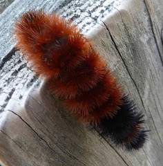
 The other treat at the wayside was to see the Fireweed in bloom. This plant, common in the northwest, was one of my nicest memories of our Alaska cruise. I remembered the Alaskan saying "When the Fireweed blooms, it is 6 weeks to the first snowfall." Well, when we were in Alaska, it was blooming, and it was early August, and the locals said that by October they would have snow. And that being Alaska, I imagine they were right. So here we were in Oregon this year in the middle of August and the fireweed was blooming. I wonder, did Cape Arago have snow in the latter half of September or the first of October? Or at least a winter storm? If the folks in Alaska were any guide, then maybe they did. But then, maybe this is as accurate as my Wooly Worm Caterpillars.
 The first side attraction is the vegetation surrounding the lake, especially when its color is contrasted with the color of the lake. Because of the large amount of moisture the area receives in the winter, much of the vegetation receives at one time or another in its life, a healthy coating of lichens and mosses, and even some “Old Man’s Beard” (kind of a Pacific Northwest version of “Spanish Moss”). Particularly when these plants are highlighted against the deep blue of the lake, the result is quite stunning.
 And then there are attractions just above the lake itself, on the walls of the Crater, I mean Caldera, I mean Big Hole. The rocks come in many hues as a result of their formation as a result of many separate volcanic actions. One of the walls (the one pictured) is even more unusual, because while part of it has eroded away, part of it,
 composed of a slightly harder rock than the rest has remained. The resulting rock formation, called “Pumice Castle” is quite stunning.
 represents the highest point in the park. Further, its north side is beginning to take on the characteristics of a special type of rock formation, a “Cirque.” We had seen several Cirque’s a few years ago in Rocky Mountain National Park, and the resemblance of the two rock formations is striking. For the record, a Cirque is a valley formed on a mountainside by glaciers. The ones we saw at Rocky Mountain National Park were considered fully formed, this one is considered a "Cirque in the making." You will note in this shot in the mid right hand side of the picture, you can still see snow, and this is the end of August. Thus, this is definitely a glacier at work.
 The other attraction we saw was an area about 7 miles to the south of the rim drive which circles “the Big Hole.” This area is called “The Pinnacles.” They are a series of rock formations
  caused when plumes of vapors from vents beneath the earth, called fumaroles, poured out ash. Over the ages, as the forces of erosion worked on the land, most of the ash was removed, except for that portion around the vent which had hardened by its close contact with the heat from beneath the earth. The residue of this erosion has become known as "The Pinnacles." While they are a little way off the beaten path, they are well worth the drive out to see.


